


As a consequence of the long lasting movement of the people, Cooper's Camp got notified by the West Bengal Government in 1997. The uprooted refugees of this locality had to struggle a lot for their survival because of not having the Government acknowledgement. Being deprived of the Government facilities and opportunities, the financial up gradation of the local people were stumbled. 1n 1942, 1946 and in1950 the up rooted people came from the other side of the border and they took shelter here in this place. Then it was considered as a Transit Camp for military food supply. In 1960 many a step had been taken by the Central Government for the rehabilitation of these people. They were rehabilitated in places like Dandakaranya, Andaman, Uttarpradesh and in West Bengal. They were also given a land of five kathas and an aid of Rs. 2000/-.
Cooper's was declared as a Panchayet in 1978 by the State Government but the citizens of Coopers were determined to boycott the election in demand of getting Cooper's Notified Area by the State Government.
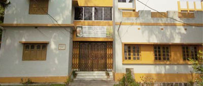
After the first election (1997) the notified area authority started functioning in the Relief Department Building. The work of building infrastructure and furniture purchasing for the office set to working under the supervision of Manish Jain, the then S.D.O. In the year of 2000 the preparation of a new municipal building started. On 29th January 2001 the Chairman of the Human Rights Commission of the state, Sri Mukul Gopal Mukherjee, laid the foundation stone of the new municipal building. On 6th December Sri Mukherjee inaugurated the new municipal building. The people of Coopers are proud of the new municipal building which is the reflection of hopes and aspirations of the general people
Coopers is located at eastern side of Ranaghat Town. The nearby N.A.A. is Ranaghat Minucipality of Nadia district. Nokari Gram Panchyet is northern boundary and Baidyapur G.P is eastern as well as southern boundary of Cooper's Notified Area Authority.
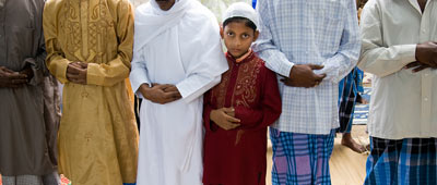
The administrative area of this Notified Area Authority is 1.5 sq. Km. According to the Census 2001, the population of Cooper's was 17,755. At the end of year 2011 the population of Cooper's has reached 18839 out of which 9570 are male and 9269 are female population. Cooper's has 12 wards with 30 slums. Almost 90% population belongs to SC Category and 60% population belongs to BPL families.
| 1 | Name of the District: | NADIA |
| 2 | Year of establishment: | 1997 |
| 3 | Area (in sq. Km): | 1.5 |
| 4 | No. of wards: | 12 |
| 5 | Population (Census 2011): | |
| 5.1 | Male | 9570 |
| 5.2 | Female | 9269 |
| 5.3 | Total | 18839 |
| 6 | Density of Population (Per sq. km.) | 12559 |
| 7 | Break up of Population (2011): | |
| 7.1 | SC | 90% of total Population |
| 7.2 | ST | NIL |
| 7.3 | Minorities | NIL |
| 8 | Date when last election held: | 2012 |
| 9 | Year of Last Assessment of Properties: | 2010 |
| 10 | Literacy Rate | 77.55% |
| 11 | Number of BPL Household (as per SUDA Survey): | 3455 |
| 12 | Slum Scenario | |
| 12.1 | Total No of Slum | 30 |
| 12.2 | Total Slum Population (as per USHA) | 17816 |
| 12.3 | Percentage of Slum Population to the total population | 94.57% |
| 13 | Housing status for Urban Poor: ( as on 31.03.14) | |
| 13.1 | No. of beneficiaries provided with Houses under BSUP / IHSDP/ | 500 |
| 14 | Length of Municipal Road: (in km.) | 62 |
| 15 | Length of Drain: (in km.) | 60.7 |
| 16 | Water Supply: | |
| 16.1 | No. of Tube well | 170 |
| 16.2 | No. of Stand post | 450 |
| 16.3 | No. of houses connected with water supply network | NIL |
| 17 | Total no. of light posts. | 918 |
| 18 | Health : | |
| 18.1 | No. of Hospital (ULB / Govt./ Private) | NIL |
| 18.2 | No. of Municipal Health Sub-Centre | 3 |
| 19 | Education : | |
| 19.1 | No. of Higher Secondary School (Municipal/ others) | NIL |
| 19.2 | No. of Secondary School (Municipal/ others) | 1 |
| 19.3 | No. of Primary School(Municipal/ others) | 10 |
| 19.4 | No. of Sishu Siksha Kendras (SSK) | NIL |
| 20 | Other Infrastructure (Both Municipal & Others) : | |
| 20.1 | Bridge | NIL |
| 20.2 | Flyover | NIL |
| 20.3 | Stadium | NIL |
| 20.4 | Parks and Gardens | 4 |
| 120.5 | Playground | 8 |
| 20.6 | Auditorium/Community Hall | 6(UC) |
| 20.7 | Bank | 2(SBI & Bank of India) |
| 20.8 | ATM | 2 |
| 20.9 | Ward office | NIL |
| 20.10 | Market | 1 |
| 20.11 | Burning Ghat | 1 |
| 20.12 | Electric Crematorium | NIL |
| 20.13 | Electric Crematorium | NIL |
| 20.14 | Public Library | NIL |
| 20.15 | Bus Terminus | NIL |
| 20.16 | Ferry Ghat | NIL |
| 20.17 | Guest House/ Tourist Lodge | NIL |
| 20.18 | Community center | NIL |
| 20.19 | Night Shelter | NIL |