


The origin of Birnagar dates back to the pre-colonial era.Previously it was an island in the Hooghly River. Before British came, Birnagar was named as Ula. It is mentioned in the short story Post Master by Rabindranath Tagore and in the novel Aporajito by Bibhutibhushan Bandopadhyay. It earlier had two zamindars. One part of Birnagar belonged to the Mukherjees, and the other part was of the Mustafis. Rajsekhar Bose (Parasuram) was from Birnagar. He was a well known author of many short stories basically comedies in Bengali. Gamchha -- a handloom towel used by Bengalis was invented in Palitpara, Birnagar.
Once Birnagar was a lag-behind village teeming with ditches, ponds, pools and cultivable lands, In spite of all that, a vast area of the village attracted all since the 18th century. The area of the land from the Churni, Bhagirati and Ichhamati at the West to the present railway track and Ranaghat – Berhampore Road is the impact of several small, yet significant municipal and panchayat areas including Birnagar. With the doyen of industrial colonization of the British rule slums began coming up one after another around and in the vicinity of the town and huts with tiled roofs were built therein which now comes within the municipal periphery (Ward numbers 1 to 14).
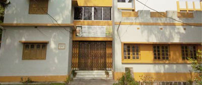
Birnagar Municipality was established in 1869 and the first chairman of the Birnagar Municipality was Kabi Nabinchandra Sen . Presently the municipality covers an area of 5.52 sq.km. and is divided into 14 wards.
Kishma Gram Panchayat on the North, Kalinarayanpur –Paharpur Gram Panchayats on the South, and Kishma Gram Panchayat & Kalinarayanpur – Paharpur Gram Panchayats on the East and Barasat Gram Panchayat on the West surround Birnagar Municipality respectively. The River Churni flows about 2 kilometers on the east of the Birnagar Municipality area.
The main civilian airport is “Netaji Subbhash Chandra Bose International Airport” (Code: VECC; IATA: CCU) at Kolkata is situated 32 nautical miles South from Birnagar. The other airports are at Barrackpore (27 nautical miles South, Code: FR3117) in India, at Jessore, Bangladesh (31 nautical miles East, Code: VGJR, IATA: JSR) and Ishurdi, Bangladesh (63 nautical miles North, Code: VGIS, IATA: IRD)
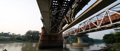
The city is well connected to Sealdah railway station. Local and passenger trains are available every half-an-hour. But due to population outburst in the intermediate stations like Chakdaha, Kalyani etc., never expect a seat during day-hours. The busy Sealdah – Krishnangar – Lalgola Main Railway Line passes through the municipal area of Birnagar ULB and divides it into two parts, with all the Ward Numbers 1 to 14 on the eastern side of the railway track, except Ward Number 2 on the western side of it. Birnagar station is 82 kilometers from Sealdah Station. The port of Calcutta is the main connectivity of water transit system in this part, and it serves Birnagar Township also.
From railway station, trains travel both north and south. Local trains are available for these places: Ranaghat, Krishnagar, Shantipur, and Sealdah. A handful of fast passengers train between Lalgola and Sealdah also goes over nearby Ranaghat. An express train Bhagirathi express, mainly for the office-goers run in the morning. To be exact it departs from Ranaghat for Sealdah at 8:50 in the morning and in the evening leaves Sealdah station at 6:25pm for Ranaghat. It takes around 1 and half hour in contrary to the 2 hours taken by the local trains. Bus service, though less used by the commoners due to the bus-stop position in a far place from the railway station, is also available. Buses ply through the 34th national highway: in north to north Bengal through Krishnagar, and to Kolkata in the south direction.
Auto-service might be popular in other cities of West Bengal, but it is not available here.
It is served by a few bus routes (private, mini, public, chartered and others) that travel very frequently on Ranaghat – Berhampore Road and connect the municipality well with the rest of the KMA as well as the rest of west Bengal and India. On top of that, NH – 34 falls at a reasonably close motorable distance near its southern periphery increases its geographical importance and connects Birnagar to a wider regional network of KMA. NH – 34, a very busy main artery of West Bengal and running north - south, not only is accessed by local people but also branches into many smaller sub-arterial roads for traveling far and near the municipality.
Birnagar is the one of the agricultural and micro-industries – based towns in West Bengal. It houses some small and medium industrial units within the periphery of its municipal limits. There are also a number of small engineering and manufacturing firms and industries. There are other industrial units dealing in production and processing textiles, steel / iron products, bidi-making, etc. The major agricultural products of the area include rice, jute, and sugarcane, and pulses.
Economy of Birnagar is mostly based on agriculture. Different types of grains starting from paddy, flour, wheat, different fruits are being produced in a vast area outside the main township, where you would find a large number of farmers and villagers. Various products from milk are transported to Calcutta each and every morning.
Another type of product which is not getting so much of government's notice is the handicraft and boutiques. At least 1000 people or more depend on this.
Besides myriad medium and small types of industries, manure producing industries, handloom – towels like gamcha and others taking together give the town a complete agro - industrial shape.
IT infrastructure is getting polularised lately here in the Birnagar Municipal Area and its surroundings.
| WARD NUMBER | TOTAL POPULATION | MALE | FEMALE |
| 1 | 3162 | 1578 | 1584 |
| 2 | 3709 | 1865 | 1844 |
| 3 | 2487 | 1258 | 1229 |
| 4 | 2464 | 1224 | 1240 |
| 5 | 2111 | 1055 | 1056 |
| 6 | 1876 | 932 | 944 |
| 7 | 1293 | 671 | 622 |
| 8 | 3007 | 1514 | 1493 |
| 9 | 2065 | 1060 | 1005 |
| 10 | 1908 | 990 | 918 |
| 11 | 1336 | 695 | 641 |
| 12 | 1466 | 775 | 691 |
| 13 | 2008 | 1049 | 959 |
| 14 | 1907 | 992 | 915 |
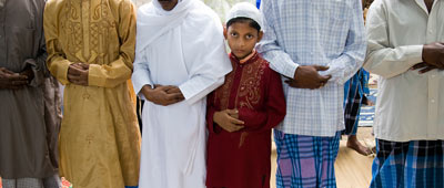
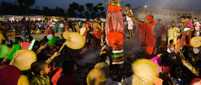
The town is inhabited mostly by Bengalis. Durga-puja like all other Bengali counterparts is celebrated throughout the entire city. All the other pujas are celebrated also.
The Christan community celebrates Christmas in style. Begopara Church inbetween Ranaghat and Birnagar becomes the center-stage of this celebration. It is situated in Begopara, on a large area outside the main township. Undoubtedly, one of the most beautiful churches of Bengal. During the Christmas, people from all the religion come here to join the party. Its worth a look. The writer sincerely requests all the people, who are yet to set their feet there must pay a visit there this December 25th.
There is a mosque in nearby Hatkhola para and Hatpukur. Devotees of Islam go there for sure.
From the very inception there was no bar on any community in the village to observe their religion independently and peacefully. At the advent of the people belonging to the different castes, creeds and languages organizing different religious festivals of the town assumed a cosmopolitan character.
Birnagar has a tropical climate. The annual mean temperature is 26.8 °C (80 °F); monthly mean temperatures range from 19 °C to 30 °C (67 °F to 86 °F). Summers are hot and humid and maximum temperatures often exceed 40 °C (104 °F) during May and June. Winter tends to last for only about two and a half months, with seasonal lows dipping to the around 10 °C – 14 °C between December and January. Often during early summer, dusty squalls followed by spells of thunderstorm and heavy rains lash the city, bringing relief from the humid heat. These thunderstorms are locally known as Kal baisakhi (Nor'westers). The average annual rainfall is 1200mm (approx.) and average maximum temperature is degree 35.0 (approx.) Celsius and minimum 10.0 (approx.) Celsius.
DEMOGRAPIC GROUTH & POPULATION PROJECTION:
| Population(as per Census) | Population(as per Socio – Economic Survey) | Population(Projected) | |||||
| Year | 1971 | 1981 | 1991 | 2001 | 2007 | 2011 | 2021 |
| Population | 10321 | 14256 | 20014 | 26597 | 26988 | 33800 | 41200 |
1. Issuing Birth , Death , Cremation certificate & trade license using e-Governance system ,
2. Building Plan ,
3. Water supply facility ,
4. Solid waste management ,
5. Water supply & developed street light facility .

